Disaster Recovery Capability
In today's environment, the effects of a long-term operations outage can have a catastrophic impact. Recovering from a disaster means enabling your organization to survive and continue normal business operations. In order to survive, your organization must be able to continue normal processing. Kansas City offers you some distinct advantages when faced with planning for such an unfortunate occurrence.
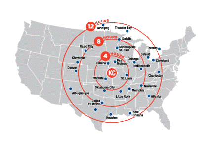
Kansas City has a central U.S. location, which reduces the likelihood that KC-based operations will become a target for disruption. And in the case that a recovery is needed, we are within a day's driving distance of a number of metropolitan areas.

Additionally, the Kansas City region boasts one of the most robust energy delivery networks in the world, as well as highly developed telecom capabilities. Transmission systems are designed and built on “first contingency” basis, so the loss of any particular generator or transmission line has no effect on supplies across the region. Local suppliers aggressively analyze and upgrade both transmission and delivery systems to ensure reliability. In general, systems here are less interconnected and less densely populated than those on the East and West Coasts. And, future reliability is being shaped by shared participation in the Southwest Power Pool.
The depth of our resources enables you to concentrate on a preventive strategy rather than focusing primarily on minimizing the impact of a disaster after it has occurred. This provides you with both economic and operational advantages. Plus, you can take comfort in the knowledge that Kansas City is a very unlikely candidate for an energy black-out!
Low Natural Disaster Area
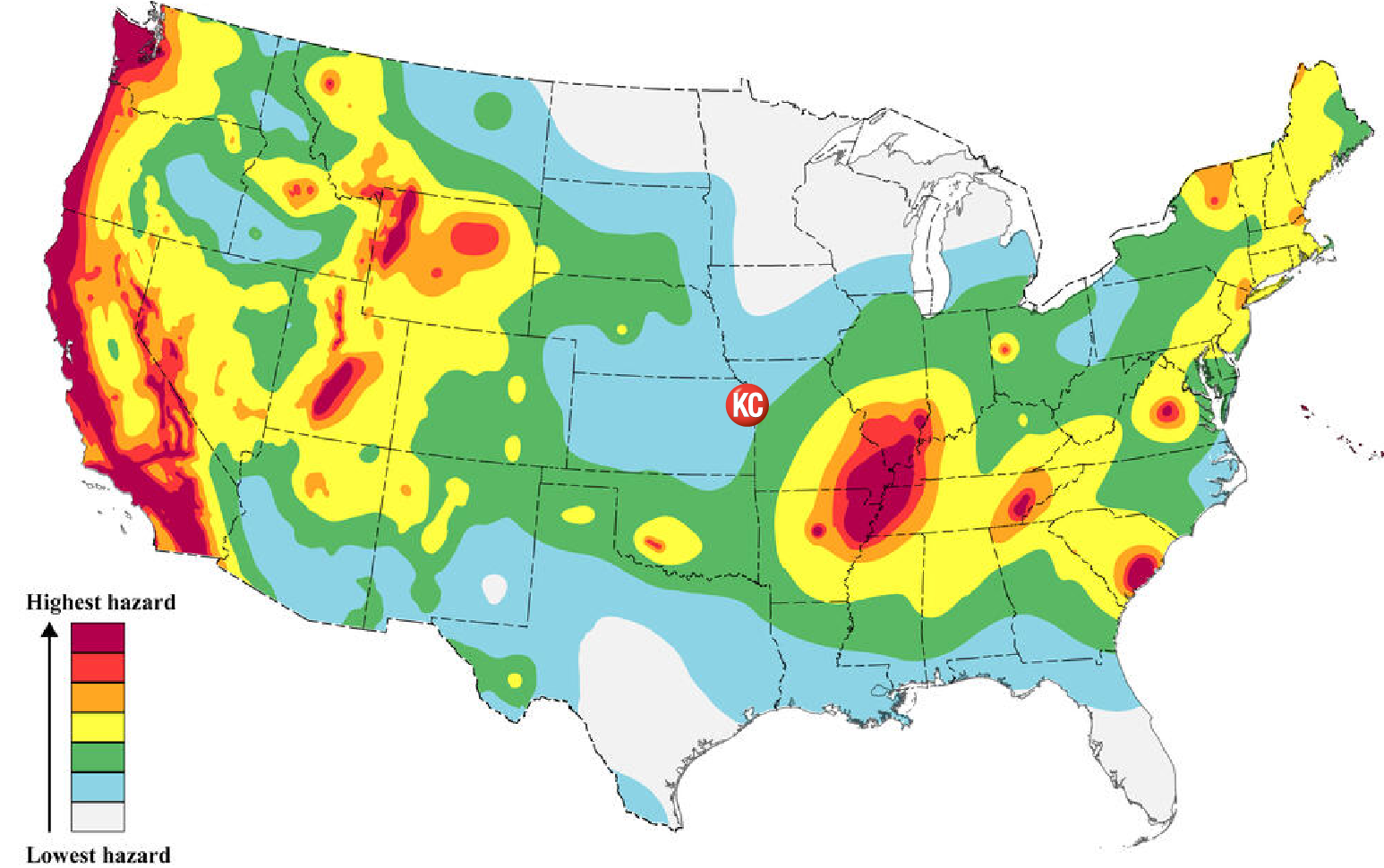
Earthquake—Greater Kansas City is located in Zone I, minor damage (Algermissen, 1969) with anticipated intensity of V-VI on the Modified Mercalli Scale. This seismicity is directly related to the New Madrid Rift Zone to the southeast and the Nemaha Uplift to the west; both features represent weak zones in the crust. Historically strong earthquakes have not occurred in the region of Greater Kansas City.
The following map, prepared by the U.S. Geological Survey, shows the Kansas City area to be in relatively little threat of significant seismic activity.

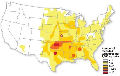
Tornado—Within a 50-mile radius of Kansas City (approximately 10,000 sq. mi.), an average of four tornadoes are sighted per year according to the National Weather Service. Tornadoes can strike in any city in the U.S. In the Midwest, tornado frequency is highest from early spring through the summer.
The following map illustrates the total annual threat of tornadoes in the United States. The mean number of days per year with one or more events within 25 miles of a point is shown by the map.

Source: NOAA, Storm Prediction Center Statistics.